|
Historic Approach to Space
Debris: Astroscale’s ADRAS-J Closes in by 50 Meters
Jun. 14, 2024
Astroscale Japan Inc. announced
that its commercial debris inspection demonstration
satellite, Active Debris Removal by Astroscale-Japan
(ADRAS-J), has achieved another unprecedented milestone
for a commercial company. ADRAS-J successfully completed
the safe and controlled approach to an unprepared space
debris object – a rocket upper stage – to a relative
distance of approximately 50 meters, collecting further
images and data while maintaining a controlled fixed
point relative position from the upper stage. This
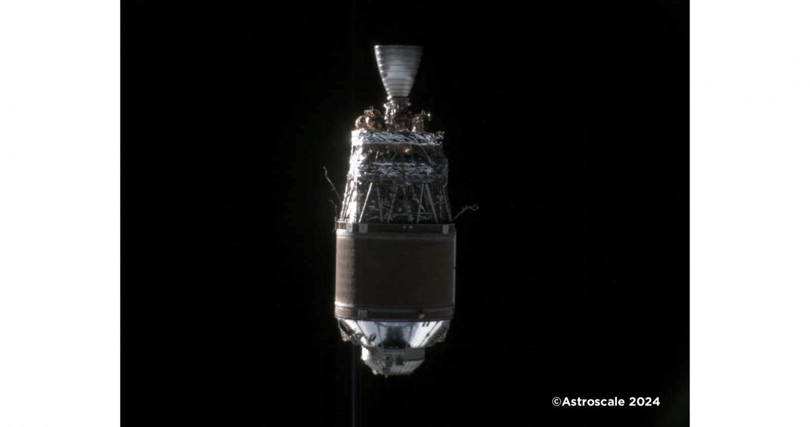
second image released from the mission, taken in May,
follows the first image released on April 26, captured
from several hundred meters behind the debris.

Space Debris Image Taken from ~50
Meters by Astroscale's ADRAS J
Image of upper stage taken by
ADRAS-J from ~50 meters.
ADRAS-J is a groundbreaking mission
as the world’s first attempt to safely approach,
characterize and survey the state of an existing piece
of large debris through Rendezvous and Proximity
Operations[1]. ADRAS-J is designed to rendezvous with an
unprepared Japanese upper stage rocket body
(approximately 11 meters long, 4 meters in diameter, and
weighing approximately 3 tons), demonstrate proximity
operations, and gather images to assess the rocket
body’s movement and condition of the structure.
Unprepared objects in orbit pose an additional challenge
as they are not designed with any technologies that
enable docking or potential servicing or removal.
The ADRAS-J mission has reached
several milestones since rendezvous operations began on
February 22. During this phase, the ADRAS-J spacecraft
started maneuvering towards the upper stage client’s
orbit using GPS and ground-based observation data. By
April 9, ADRAS-J had successfully detected the client
with its on-board visual camera and started the
proximity approach phase, underscored by starting Angles
Only Navigation, a navigation method used to estimate
relative position and velocity through the servicer’s
on-board cameras. When ADRAS-J was within a few
kilometers of the debris, the team successfully
transitioned relative navigation control to the on-board
infrared camera with Astroscale developed Model Matching
Navigation (MMN) algorithms. This navigation method
estimates relative distance by comparing captured images
or data of the client to a pre-existing model. On April
16, ADRAS-J began using MMN to process data on the
client’s characteristics, such as the shape and
attitude, and successfully approached a relative
distance of several hundred meters by April 17. In May,
ADRAS-J safely and successfully approached the client to
approximately 50 meters and conducted fixed-point
observations.
The major mission highlights
include:
Feb. 18: launch and start of
in-orbit operations.
Feb. 22: start of the rendezvous
phase.
Apr. 9: start of Angles Only
Navigation and proximity approach from several hundred
kilometers.
Apr. 16: start of MMN relative
navigation techniques.
Apr. 17: approach to the client
within several hundred meters.
May 23: approach to the client
within 50 meters.
In the next phase, ADRAS-J will
attempt to capture additional images of the upper stage
through various controlled close approach operations.
The images and data collected are expected to be crucial
in better understanding the debris and providing
critical information for future removal efforts.
|